All posts by Ted Bragg

FIVE-year Outcome #3

World Heritage properties

Five-Year Outcome: By 2023, invasive species management has reduced threats to the natural heritage Outstanding Universal Value of World Heritage properties through the implementation of priority actions.

Investment Priorities:

  • Great Barrier Reef
  • Wet Tropics of Queensland

Background Information:


Great Barrier Reef

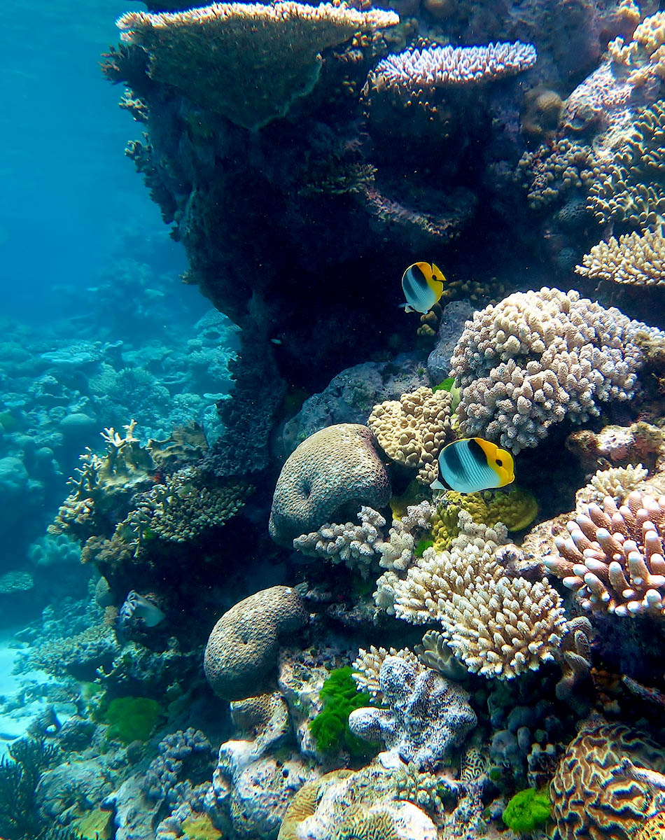
The Great Barrier Reef (GBR) is the world’s largest coral reef system, stretching along the majority of the east coast of Queensland, starting north of Fraser Island (K’gari) and ending at Cape York, a total of 2,300km. The GBR was selected as a World Heritage Site in 1981 and is contained within the GBR World Heritage Area (GBRWHA), which is approximately 348,000km2.

The GBRWHA meets all four of the criteria for natural heritage for selection as a World Heritage Site as it:

  1. Contains superlative natural phenomena or areas of exceptional natural beauty and aesthetic importance.
  2. Is an outstanding example representing major stages of earth’s history, including the record of life, significant on-going geological processes in the development of landforms, or significant geomorphic or physiographic features.
  3. Is an outstanding example representing significant on-going ecological and biological processes in the evolution and development of terrestrial, fresh water, coastal and marine ecosystems and communities of plants and animals.
  4. Contains the most important and significant natural habitats for in-situ conservation of biological diversity, including those containing threatened species of outstanding universal value from the point of view of science or conservation.

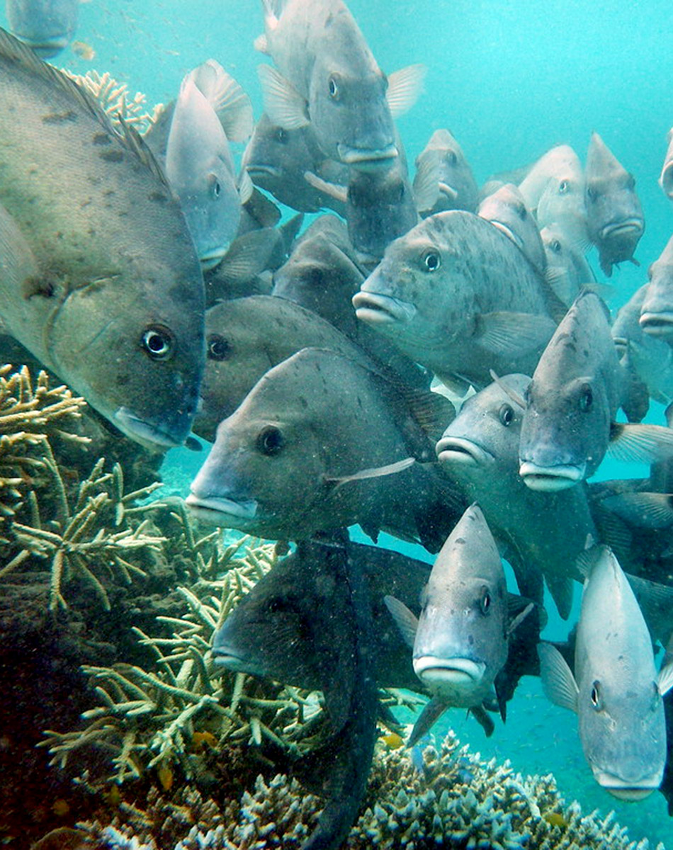
Within the GBRWHA there are some 3,000 individual reefs of varying sizes and shapes, and over 1050 islands. The diversity of habitats provided including terrestrial, estuarine and marine habitats across such a large area mean that the GBR WHA supports one of the richest and most complex natural systems on earth. This includes over 1,625 species of fish, about 600 species of coral, 4,000 species of mollusc, and 240 species of birds, plus sponges, anemones, marine worms, crustaceans, and other species.

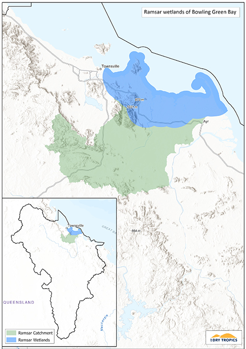
The boundary of the Burdekin Dry Tropics NRM area encompasses the entire coast line of the region and the off-shore area from the Palm Islands group in the north to Gloucester Island in the south, with a marine area of approximately 559,836ha. Magnetic Island is also included in the Burdekin Dry Tropics region. The marine area is primarily characterised by shallow waters, supporting inshore reefs and sea grass beds and the estuarine interface between marine and freshwater environments.

The marine and estuarine areas support a wide range of fish, bird and marine mammal and reptile species, notably dugongs, dolphins and marine turtles. Beach areas such as Cape Upstart are important nesting sites for flatback turtles. The freshwater systems that connect with the GBR lagoon are also vital for species of fish that need to complete part of their lifecycle in freshwater.

There are five catchment areas that drain directly to the GBR:

  • Black;
  • Ross;
  • Haughton;
  • Burdekin; and
  • Don.

The annual discharge from these catchments to the reef is 12,721GL.

 The primary threats to the condition of the GBR are:

  • climate change;
  • land-based run-off;
  • coastal land use change; and
  • direct use.

Within the Burdekin Dry Tropics NRM region, the primary threat to the inshore reefs and sea grass beds that can be managed locally is land-based run-off, including fine sediment, nutrients and pesticides. For each of the five catchments listed above, there are water quality targets and priorities, primarily related to sediment and nutrients.

Above-average rainfall events and cyclones can also have a significant impact on the health of the inshore reefs and seagrass beds.

In the 2019 Reef Report card the Burdekin scored:

  • Seagrass – D (Poor)
  • Coral – C (Moderate)
  • Water Quality – D (Poor)

Management of the Great Barrier Reef Marine Park within the GBRWHA is primarily the responsibility of the Great Barrier Reef Marine Park Authority (GBRMPA), who work under the Great Barrier Reef Marine Park Act (1975). The Reef 2050 Long Term Sustainability Plan provides the overarching strategies and framework for conservation and monitoring of the GBR. Management of GBRWHA areas outside of the Marine Park are jointly managed by GBRMPA and Queensland Parks and Wildlife Service, as part of the Department of Environment and Science. The GBRWHA stretches across six of the twelve NRM areas in Queensland; Cape York, Wet Tropics, Burdekin, Mackay Whitsunday, Fitzroy and Burnett Mary.

Current Projects:

There is currently one project funded through Reef Trust in the Great Barrier Reef area of the Burdekin Dry Tropics region; Marine Debris Clean-up and Prevention in the Great Barrier Reef. This project is managed by the Tangaroa Blue Foundation, in partnership with Conservation  Volunteers Australia and is a five year project, removing and preventing litter from entering the waters of the Great Barrier Reef.

Many of the land-based projects with an agricultural focus (see Outcome 5) are also contributing to the health of the Great Barrier Reef through improvements in water quality.

Alignment with Sub-regional aspirations and regional goals:

The Great Barrier Reef lies within the following sub-regions and aligns with their sub-regional goals:

  • Townsville Coastal Plains and Offshore sub-region.
    Catchment to reef water management — Our community sees water as the most valuable natural asset and we need to take a holistic view on how it is managed to protect the quality of the water entering the GBR. Working with stakeholders across our region and with our neighbours, we will strive to collaboratively manage our waterways for low impact use, and diligently control sediments, nutrients and pest aquatic species (page 16)
  • Lower Burdekin and Offshore sub-region.
    Effective management of water and energy for productivity and the environment — Our community recognises the link between adopting innovation and profitability, and that efficient use of energy and water increases agricultural productivity and environmental protection. We will achieve this by sharing information, adopting beneficial technologies and clearly measuring results to build community resilience, successful enterprises, and the health of our local groundwater systems, rivers, wetlands and the GBR (page 18)
  • Bowen catchments and offshore sub-region.
    Effective management of water and energy for productivity and the environment — Our community recognises the link between adopting innovation and profitability, and that efficient use of energy and water increases agricultural productivity and environmental protection. We will achieve this by sharing information, adopting beneficial technologies and clearly measuring results to build community resilience, successful enterprises, and the health of our local groundwater systems, rivers, wetlands and the GBR

This outcome aligns with the regional goals in the NRM Plan:

  • The ecological integrity and physical stability of watercourses, wetlands and marine ecosystems are restored and maintained (page 55).
  • The Great Barrier Reef is protected as an exceptional natural resource (page 55).
  • The unique biodiversity of the Burdekin Dry Tropics region is protected and enhanced to increase the resilience of native species, ecosystems and ecological processes (page 67).

The right to protect Country and culture is fundamental to Traditional Owners as the custodians of Country based on a history of more than 60,000 years. Traditional Owners aspire to have greater management, involvement and empowerment over Country and their cultural knowledge and understanding of Country are embraced. The Traditional Owner aspirations for the region can be found in the Burdekin Dry Tropics NRM Plan (pages 25-26), Caring for Country Plan (2005) and the Indigenous Participation Plan. Access to Country to connect and manage cultural and natural resources continue to be priorities for Traditional Owners. A map of Traditional Owner group areas can be accessed here.

The Aboriginal and Torres Strait Islander Heritage Strategy for the Great Barrier Reef Marine Park is GBRMPA’s long term strategy to strengthen protection for Aboriginal and Torres Strait Islander Reef heritage.

Key Collaborators

This list does not cover all groups or organisations, but rather represents the ‘key’ organisations and groups whose assistance, advice, approval or cooperation would be required to work in the areas of the Great Barrier Reef that are found in the Burdekin Dry Tropics region.

  • Great Barrier Reef Marine Park Authority (GBRMPA)
  • Department of Agriculture, Water and Environment (DAWE)
  • Queensland Department of Environment and Science (DES)
  • Queensland Parks and Wildlife Service (QPWS)
  • Townsville and Bowen-Burdekin Local Marine Advisory Committees (LMACs)
  • Traditional owner groups including Nwaigai, Manbarra, Wulgurukaba, Bindal, Juru, and Gia.
  • Local Governments (see NRM Plan Page 29)
  • NQ Dry Tropics (regional NRM group)

Monitoring:

Monitoring for the Great Barrier Reef is coordinated by the Great Barrier Reef Marine Park Authority under the Reef 2050 Integrated Monitoring and Reporting Program (RIMReP), based on the Integrated monitoring framework for the Great Barrier Reef World Heritage Area. Through this, a knowledge system has been developed, where information from monitoring activities can be accessed. Results are also reported through the Reef Report Cards.

Links and further information:


Wet Tropics

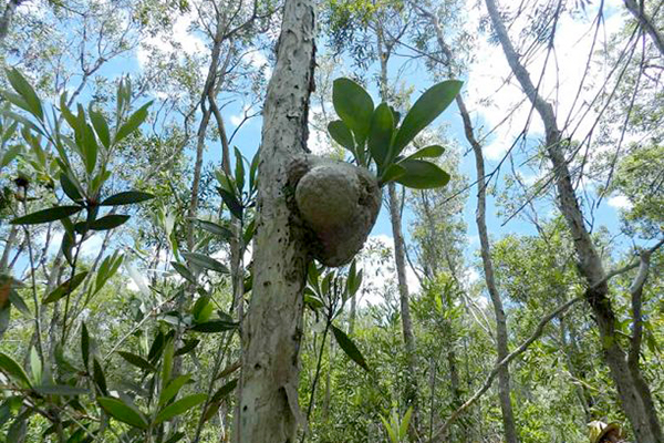
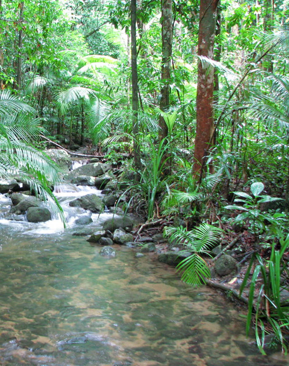
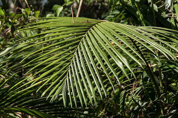
The Wet Tropics of Queensland World Heritage Area (WHA) consists of approximately 8940km2 of Australian wet tropical forests growing along the north-east Queensland portion of the Great Dividing Range. The southern-most extent of the Wet Tropics WHA is in Paluma Range National Park, covering an area of 172 km2, the bulk of which lies within the most northern extent of the Burdekin Dry Tropics region. There are over 30 National Parks who lie completely or partly within the WHA.

The Wet Tropics of Queensland had World Heritage status declared in 1988 and meets all four of the criteria for natural heritage for selection as a World Heritage Site as it:

  • represents a major stage of the earth’s evolutionary history;
  • is an outstanding example of ongoing ecological and biological processes;
  • contains superlative natural phenomena; and
  • contains the most important natural habitats for conservation of biological diversity.

The Wet Tropics WHA is home to a number of threatened plant and animal species, some of which are endemic to the Wet Tropics:

  • Animal species: 4 Critically endangered, 19 Endangered and 9 Vulnerable.
  • Plant species: 4 Critically endangered, 28 Endangered and 40 Vulnerable.

The Wet Tropics Bioregion also contains 185 Regional Ecosystems (18 of which are endangered, a further 134 are of concern).

Within Paluma Range National Park, there are 625 animal species recorded and 1456 plant species. This includes a number of threatened species:

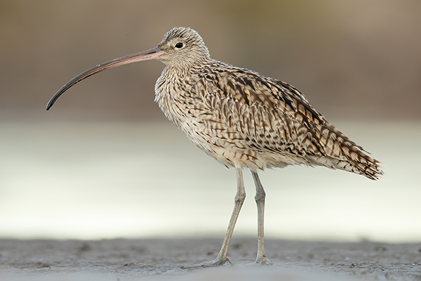
  • 4 Critically endangered species (3 bird, 1 reptile) – including the Eastern Curlew.
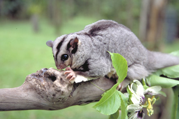
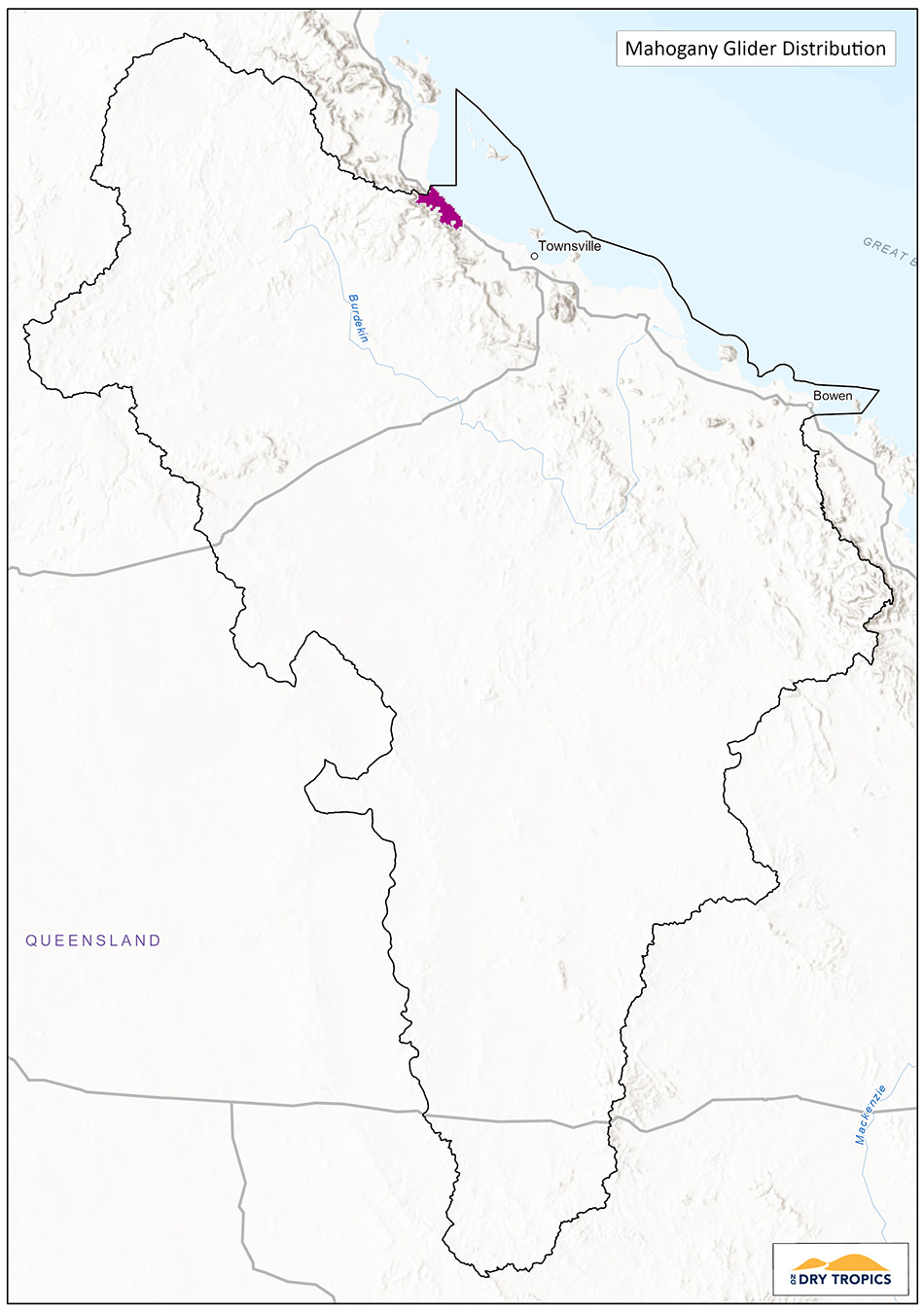
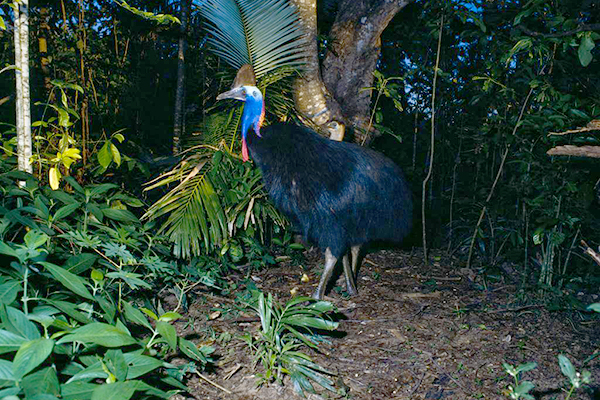
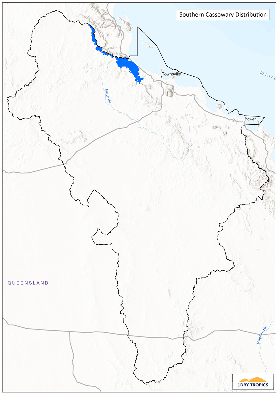
  • 7 Endangered species (4 mammal, 3 bird, 1 reptile) – including the Southern Cassowary and Mahogany Glider.

There is a wide range of threats to the Wet Tropics WHA including:

  • Fragmentation.
  • Climate change.
  • Weeds.
  • Feral animals.
  • Altered fire regimes.
  • Altered water flows and water quality.
  • Cyclones.

Additionally there are a range of pressures that impact on the WHA including:

  • Regional population growth.
  • Urban development and pollution.
  • Demand for community infrastructure (water, roads, electricity).
  • Farming (agriculture, grazing and aquaculture).
  • Tourism and recreation.

The IUCN 2020 Conservation Outlook Assessment gave an overall rating of ‘Significant Concern’ for the Wet Tropics WHA, primarily due to the threat posed by invasive plants, animals and diseases, and the impacts of climate change.

Management of the larger Wet Tropics WHA is coordinated by the Wet Tropics Management Authority. The Wet Tropics Management Plan was first published in 1998 and was revised and updated in 2020. Management of the Wet Tropics WHA contained within Paluma Range National Park (and other National Parks with areas inside the WHA) is primarily undertaken by the Queensland Parks and Wildlife Service, as part of the Department of Environment and Science. The bulk of the Wet Tropics WHA is contained in the two Natural Resource Management areas of Terrain NRM and Cape York NRM who undertake activities to reduce the threats to the WHA.

Current Projects:

There are currently no projects being undertaken in Burdekin Dry Tropics area of the Wet Tropics WHA.

Alignment with Sub-regional aspirations and regional goals:

This outcome aligns with the regional goal in the NRM Plan:

  • The unique biodiversity of the Burdekin Dry Tropics region is protected and enhanced to increase the resilience of native species, ecosystems and ecological processes (page 67).

The right to protect Country and culture is fundamental to Traditional Owners as the custodians of Country based on a history of more than 60,000 years. Traditional Owners aspire to have greater management, involvement and empowerment over Country and their cultural knowledge and understanding of Country are embraced. The Traditional Owner aspirations for the region can be found in the Burdekin Dry Tropics NRM Plan (pages 25-26), Caring for Country Plan (2005) and the Indigenous Participation Plan. Access to Country to connect and manage cultural and natural resources continue to be priorities for Traditional Owners. A map of Traditional Owner group areas can be accessed here.

Key Collaborators

This list does not cover all groups or organisations, but rather represents the ‘key’ organisations and groups whose assistance, advice, approval or cooperation would be required to work on the areas of the Wet Tropics that lie within the Burdekin Dry Tropics region.

  • Department of Agriculture, Water and Environment (DAWE).
  • Queensland Department of Environment and Science (DES).
  • Queensland Parks and Wildlife Service (QPWS).
  • Wet Tropics Management Authority (Division of DES).
  • Nywaigi and Warrungnu Traditional Owners and Girringun Reference Group.
  • Terrain NRM (regional NRM group).
  • NQ Dry Tropics (regional NRM group).

Monitoring:

Given the size and complexity of the Wet Tropics WHA, monitoring is predominantly undertaken on specific sites, or specific species. For the areas of the WHA that lie within National Park boundaries, the Queensland National Park and Wildlife Service (QPWS) is primarily responsible for monitoring.

Other monitoring programs and sources of data are available through the below link:

Links and further information:


FIVE-year outcome #2

Threatened and EPBC Act
priority species

Five-Year Outcome: By 2023, the trajectory of species targeted under the Threatened Species Strategy and other EPBC Act priority species is stabilised or improved

Investment Priorities:

  • Ant Plant (Myrmecodia beccarii)
  • Eastern Curlew (Numenius madagascariensis)
  • Southern Cassowary (Casuarius casuarius johnsonii)
  • Greater Bilby (Macrotis lagotis)
  • Mahogany Glider (Petaurus gracilis)

Background Information:

The Burdekin Dry Tropics region is home to a number of threatened species:

  • 7 Critically Endangered species (1 mammal, 3 bird, 1 reptile, 1 amphibian and 1 fish species);
  • 23 Endangered species (7 mammal, 7 bird, 4 reptile, 1 amphibian and 4 land plant species);
  • 47 Vulnerable species (10 mammal, 9 bird, 7 reptile, 2 amphibian, 1 fish and 18 land plant species).

Twenty species have Recovery Plans and 33 have Conservation Advice.

 Current Projects:

There are currently no projects being undertaken for this outcome or these investment priorities in the Burdekin Dry Tropics region, as the majority of the critical habitat for these species occurs outside the region.

Alignment with Sub-regional aspirations and regional goals:

This outcome aligns with the regional goal in the NRM Plan:

  • The unique biodiversity of the Burdekin Dry Tropics region is protected and enhanced to increase the resilience of native species, ecosystems and ecological processes (page 67).

The right to protect Country and culture is fundamental to Traditional Owners as the custodians of Country based on a history of more than 60,000 years. Traditional Owners aspire to have greater management, involvement and empowerment over Country and their cultural knowledge and understanding of Country are embraced. The Traditional Owner aspirations for the region can be found in the Burdekin Dry Tropics NRM Plan (pages 25-26), Caring for Country Plan (2005) and the Indigenous Participation Plan. Access to Country to connect and manage cultural and natural resources continue to be priorities for Traditional Owners. A map of Traditional Owner group areas can be accessed here.


Ant Plant

Status:
Vulnerable – Nature Conservation (Plants) Regulation 2020 (Queensland)
Vulnerable – Environment Protection and Biodiversity Conservation Act 1999 (EPBC Act).

 Conservation Advice:
Approved Conservation Advice (2008)

Recovery Plan:
There is no adopted or made Recovery Plan for this species

Threat Abatement Plan:
There is no Threat Abatement Plan identified as relevant for this species

Background Information:

The Ant Plant (Myrmecodia beccarii) is a tuberous epiphyte (a plant growing on other plants without harming them) found in the wet tropics of Queensland. It is known to occur in open coastal woodlands dominated by melaleuca or mangroves, between Cooktown and Ingham.

The species is conserved within the Girringun National Park (NP), Daintree NP and Edmund Kennedy NP.

The majority of the range of this species occurs in the Wet Tropics, however a small section of Girringun National Park is in the northern-most area of the Burdekin Dry Tropics region.

This species has a unique association with the Golden Ant (Iridiomyrmex cordatus) which lives in the chambers of the tuber and the Apollo Jewel butterfly (Hypochrysops apollo apollo) which lays its eggs on the plant. The golden ants carry the butterfly eggs into the chambers where they develop into butterflies.

The main threats to this species are habitat loss, invasive weeds, removal of plants by plant and butterfly collectors.

Priority actions identified to assist this species are:

  • Protect, maintain and expand habitat through weed control, revegetation and fencing
  • Raise awareness about impacts of illegal collecting
  • Grow horticulturally

This species occurs primarily in areas managed by the Wet Tropics Management Authority, Queensland National Parks and Wildlife Service (Department of Environment and Science) and the Wet Tropics (Terrain) and Cape York NRM regions.

Key Collaborators

This list does not cover all groups or organisations, but rather represents the ‘key’ organisations and groups whose assistance, advice, approval or cooperation would be required to work on Ant Plant in the Burdekin Dry Tropics region.

  • Department of Agriculture, Water and Environment (DAWE)
  • Queensland Department of Environment and Science (DES)
  • Queensland Parks and Wildlife Service (QPWS)
  • Nywaigi anbd Wulgurukaba Traditional Owners and Girringun Reference Group
  • NQ Dry Tropics (regional NRM group)
  • Terrain NRM (regional NRM group)
  • Wet Tropics Management Authority (Division of DES)

Monitoring:

There are currently no monitoring programs with publicly available information being undertaken. The Conservation Advice for the species specifies the requirement to establish monitoring programs and support any currently underway, both at a local and regional level.

Potential indicators for the Ant Plant:

  • presence and abundance;
  • distribution; and
  • presence/abundance of Golden Ants and Apollo Jewel Butterflies.

Links and further information:

Eastern Curlew

Status:
Endangered – Nature Conservation (Animals) Regulation 2020 (Queensland).
Critically Endangered – Environment Protection and Biodiversity Conservation Act 1999 (EPBC Act).
Endangered – IUCN Red List.

Conservation Advice:
Approved Conservation Advice (2015).

Recovery Plan:
There is no adopted or made Recovery Plan for this species (the approved conservation advice for the species provides sufficient direction to implement priority actions and mitigate against key threats).

Threat Abatement Plan:
There is no Threat Abatement Plan identified as relevant for this species.

Background Information:

The Eastern Curlew (Numenius madagascariensis) is a migratory shorebird species. It is the largest shorebird in the world and undertakes an annual migration between the northern and southern hemispheres. The breeding grounds of the Eastern Curlew are in north-eastern Asia including Siberia, Russia and Mongolia, while the wintering grounds are primarily in coastal Australia, with lower numbers wintering in south-east Asia (South Korea, Thailand and the Philippines), Papua New Guinea and New Zealand. The intertidal mud flats of the Yellow Sea are a critical habitat that are used during migration as a stop-over and staging sites.

In the southern hemisphere (non-breeding season) it is typically found in coastal areas such as seagrass beds, mangrove swamps, saltmarshes, tidal flats and beaches. In these areas they use their long, curved beak to probe the substrate to feed on marine invertebrates such as molluscs, crustaceans and worms.

In Australia, it has been recorded in coastal areas in all states, however south-eastern Queensland has the highest concentration of numbers around Moreton Bay and Sandy Straight. In the Burdekin Dry Tropics region, sighting have been made at Bowling Green Bay and in coastal areas north of this.

This species is listed in bilateral migratory bird agreements; Bonn Convention on the conservation of migratory species, CAMBA (China), JAMBA (Japan) and ROKAMBA (Republic of Korea).

As a migratory bird that ranges over a large geographical distance and relies on habitat along the migratory path in order to successfully undertake the migratory journey, there are a wide range of threats to this species including habitat destruction and disruption due to coastal development affecting breeding and feeding opportunities, hunting and predation, being by-catch in fishing nets and the impacts of climate change and pollution.

In Australia, the primary threats are loss of and disruption to coastal habitats used for foraging and roosting. This is due to coastal development and use of coastal areas, such as walking dogs off leash. In the Burdekin Dry Tropics region the habitat used by the Eastern Curlew occurs along the coastline, including areas within Great Barrier Reef Marine Park.

At an international level, work to address the threat to the species is concentrated on maintaining and implementing the bilateral agreements to protect and restore breeding and migration stop-over sites. In Australia, management actions are concentrated on the maintenance and protection of roosting and feeding sites, incorporation of the requirements for the species in coastal planning and management and managing disturbance at important sites. Within the Burdekin Dry Tropics, the shorebird vulnerability assessment undertaken by the Great Barrier Reef Marine Park authority lists 14 specific actions to address vulnerabilities for shorebird species, including further research and monitoring, protection of areas outside existing conservation reserves, managing threats such as pest species, marine debris and human disturbance and working with other states and countries to protect migration flyways.

This species occurs in areas managed by the Great Barrier Reef Marine Park Authority, the QLD National Parks and Wildlife Service, local councils and private owners.

 Key Collaborators:

This list does not cover all groups or organisations, but rather represents the ‘key’ organisations and groups whose assistance, advice, approval or cooperation would be required to work on the Eastern Curlew in the Burdekin Dry Tropics region.

  • Department of Agriculture, Water and Environment (DAWE)
  • Queensland Department of Environment and Science (DES)
  • Queensland Parks and Wildlife Service (QPWS)
  • Nywaigi, Manbarra, Wulgurukaba and Bindal Traditional Owners, Girringun Reference Group and Gudjuda Reference Group
  • Great Barrier Reef Marine Park Authority
  • Townsville City Council
  • Burdekin Shire Council
  • Whitsunday Regional Council
  • Queensland Wader Study Group
  • NQ Dry Tropics (regional NRM group)

 Monitoring:

Threatened Species Recovery Hub project and monitoring – https://www.nespthreatenedspecies.edu.au/projects/strategic-planning-for-the-far-eastern-curlew https://www.nespthreatenedspecies.edu.au/news-and-media/latest-news/curlew-globe-trotting-update

 Potential indicators for the Eastern Curlew:

  • Presence / abundance at coastal wintering sites
  • Banding and capture / recapture data
  • Availability and condition of suitable habitat

 Links and further information:


Greater Bilby

Status:

Endangered – Nature Conservation (Animals) Regulation 2020 (Queensland).
Vulnerable – Environment Protection and Biodiversity Conservation Act 1999 (EPBC Act).
Vulnerable – IUCN Red List.

Conservation Advice:
Approved Conservation Advice (2016)

Recovery Plan:
There is a National Recovery Plan for this species.

Threat Abatement Plan:
There are three Threat Abatement Plans for this species (Feral cats, foxes and rabbits).

Background Information:

The Greater Bilby (Macrotis lagotis) (hereafter referred to as ‘bilby’) is one of two species of bilby that occurred in Australia, with the Lesser Bilby (Macrotis leucura) declared extinct.

The bilby is a ground-dwelling, burrowing marsupial that is most closely related to bandicoots and is roughly the size of a rabbit. It is nocturnal, coming out of the burrow at night to feed. It is omnivorous, eating insects such as termites, seeds, fungi, bulbs and fruit. They do not require free water to drink, as they are adapted to arid environments and are able to extract sufficient moisture from their food. Bilbies can live to around seven years of age and are capable of reproducing quickly in favourable conditions, with females able to produce up to eight young per year. As with other marsupials, the female gives birth to undeveloped young who complete their development in the pouch.

Prior to European settlement, the bilby was widespread in Australia, found in arid through to temperate coastal areas, however primarily due to the impacts of habitat loss and introduced animals their range has contracted severely to primarily arid and semi-arid regions and restricted areas in which populations remain.

In Queensland, their distribution, which once covered most of the state south of the Wet Tropics, has been reduced to remnant populations in the south west of the state, with the largest remaining population in an area west of the Diamantina River, in Astrebla Downs National Park, Diamantina National Park and some pastoral properties. In 2019 the greater bilby was reintroduced to a 2,500 hectare predator-free enclosure on Currawinya National Park near the Queensland-New South Wales border.

There are no known current populations in the Burdekin Dry Tropics Region.

The decline in this species has occurred due to habitat disturbance brought about primarily through grazing and from competition with and predation by introduced species. The change in habitat brought through large grazing animals (sheep and cattle), changed fire regimes and the installation of watering points have impacted on the viability of bilby populations. However, at this time the largest threat is from introduced predators, the feral cat and fox, which prey heavily on bilbies.

Management is primarily undertaken by the Department of Environment and Science and Queensland National Parks and Wildlife Service (where Bilby populations are within National Park boundaries). The actions required to prevent further losses and increase populations are provided in the National Threatened Species Recovery Plan for the species:

  1. Reduce impact of predation by introduced carnivores.
  2. Maintain genetic diversity through captive breeding program.
  3. Establish self-sustaining populations within former range.
  4. Monitor trends in occurrence and abundance.
  5. Assess the impact of predators, fire and other threatening processes on bilby populations.
  6. To inform and involve the community and all stakeholders in the recovery process.
  7. Continue to manage the recovery process through a national recovery team.

Key Collaborators

This list does not cover all groups or organisations, but rather represents the ‘key’ organisations and groups whose assistance, advice, approval or cooperation would be required to work on the Greater Bilby in Queensland.

  • Department of Agriculture, Water and Environment (DAWE)
  • Queensland Department of Environment and Science (DES)
  • Queensland Parks and Wildlife Service (QPWS)
  • National Bilby Recovery Team
  • Save the Bilby Fund
  • Traditional Owner groups

Monitoring:

Monitoring on properties that are owned and / or managed by Not for Profit organisations such as the Australian Wildlife Conservancy are conducted by the relevant organisation. Likewise, any populations within National Parks are monitored by the Queensland National Parks and Wildlife Service (QPWS). Other monitoring programs and sources of data are available through the below links:

 Potential indicators for bilbies include:

  • Presence and abundance
  • Availability and use of suitable habitat
  • Rates and causes of mortality
  • Fecundity

Links and further information:

Mahogany Glider

Status:
Endangered – Nature Conservation (Animals) Regulation 2020 (Queensland).
Endangered – Environment Protection and Biodiversity Conservation Act 1999 (EPBC Act).
Endangered – IUCN Red List.

Conservation Advice:
There is no approved Conservation Advice for this species.

Recovery Plan:
There is a National Recovery Plan for this species.

Threat Abatement Plan:
There is one Threat Abatement Plan for this species (Feral cats).

Background Information:

The Mahogany Glider (Petaurus gracilis) is one of six species in the genus Petaurus, or ‘wrist-winged gliders’ that also includes the Sugar Glider, Squirrel Glider and Yellow-bellied Glider.

These arboreal (living in trees) marsupials have specialised fold of loose skin extending between the wrist and ankle on each side, that when extended act as ‘wings’ that enable them to glide for distances over 100m. They use this form of movement to move between trees, thereby avoiding descending to the forest floor. Their diet is made up of nectar, pollen, plant exudate, insects, honeydew and Acacia seed arils.

Mahogany Glider habitat is tropical lowland open eucalypt and melaleuca woodland. They occur only in Queensland and have a very limited range, stretching around 120km along the east coast from Hull River in the north (near Tully) to Ollera Creek in the south (near Ingham) and around 100km inland to the lower Herbert Gorge area and the foothills of the Mt Fox section of Girrungun National Park. In the Burdekin Dry Tropics NRM region, this includes the southern section of Paluma National Park and the Mt Fox section of Girrungun National Park.

The primary threats to the species, identified in the National Threatened Species Recovery Plan are clearing of habitat (primarily for agriculture) and degradation and fragmentation of remaining habitat, due to grazing, fire regimes, weed incursion and road development. Vehicle strikes and entanglement on barbed wire fences have also been recorded.

Management is primarily undertaken by the Department of Environment and Science and Queensland National Parks and Wildlife Service (where populations are within National Park boundaries). The actions required to prevent further losses and increase populations are provided in the National Threatened Species Recovery Plan for the species:

  1. Update mahogany glider habitat mapping and identify areas for protection, restoration and management.
  2. Develop strategies to conserve mahogany glider habitat on private lands.
  3. Identify, manage and monitor habitats threatened by encroaching rainforest.
  4. Implement habitat recovery burns at key sites and improve weed control.
  5. Promote a mahogany glider friendly-fencing scheme.
  6. Reduce threats arising from transport and easement corridors.
  7. Determine the population genetic structure of mahogany gliders.
  8. Review the recovery plan.

Key Collaborators

This list does not cover all groups or organisations, but rather represents the ‘key’ organisations and groups whose assistance, advice, approval or cooperation would be required to work on the Mahogany Glider in the Burdekin Dry Tropics region.

  • Department of Agriculture, Water and Environment (DAWE)
  • Queensland Department of Environment and Science (DES)
  • Queensland Parks and Wildlife Service (QPWS)
  • Wet Tropics Management Authority (Division of DES)
  • Mahogany Glider Recovery Team
  • Nywaigi, Warrungnu and Gugu Badhun Traditional Owners and Girringun Reference Group
  • Wildlife Preservation Society of Queensland – Glider Network (Conservation Not for Profit group)
  • Terrain NRM (regional NRM group)
  • NQ Dry Tropics (regional NRM group)

 Monitoring:

Populations within National Parks are monitored by the Queensland National Parks and Wildlife Service (QPWS), companies such as Powerlink Queensland Pty Ltd that undertake work in Mahogany Glider habitat also undertake monitoring as part of their activities. The Queensland Glider Network has also undertaken monitoring activities – https://wildlife.org.au/queensland-glider-network/.

Other monitoring programs and sources of data are available through the below links:

Potential indicators for mahogany gliders include:

  • Presence and abundance
  • Availability and use of suitable habitat
  • Rates and causes of mortality
  • Fecundity

 Links and further information:

Southern Cassowary

Status:
Endangered – Nature Conservation (Animals) Regulation 2020 (Queensland).
Endangered – Environment Protection and Biodiversity Conservation Act 1999 (EPBC Act).
Least Concern – IUCN Red List.

Conservation Advice:
There is no approved Conservation Advice for this species.

Recovery Plan:
There is a National Recovery Plan for this species.

Threat Abatement Plan:
There is one Threat Abatement Plan for this species (Feral pigs).

Background Information:

The Southern Cassowary (Casuarius casuarius johnsonii) is a large, flightless bird that is one of three cassowary species. It is the only cassowary species that is found in Australia, with the other species found in Papua New Guinea.

Southern Cassowaries are found only in the Wet Tropics, primarily in rainforest (although they may use associated areas, such as woodland). The bulk of the diet is comprised of fleshy fruits that are foraged from the forest floor or directly from the plant. They will also eat small vertebrates, invertebrates, fungi, plants and carrion.

The distribution of the Southern Cassowary stretches from Cooktown in the north, to Paluma in the south. Core habitat is coastal lowlands between Ingham and Mossman, and uplands in the southern Atherton Tablelands and other ranges, as well as areas of Cape York. In the Burdekin Dry Tropics region, the range of the Southern Cassowary extends into the most southern area of Paluma National Park.

Management of the Southern Cassowary within National Parks is primarily managed by the Queensland National Parks and Wildlife Service. Outside of park boundaries, management is undertaken through a coordinated effort between local, state and national government, community groups and other organisations, such as regional NRM groups.

There are eight main threats to the Southern Cassowary as laid out in the National Threatened Species Recovery Plan:

  1. Habitat loss from clearing: more than 80 per cent of coastal lowland habitat has gone.
  2. Habitat fragmentation: much of remaining habitat is fragmented, isolating groups and disrupting movement.
  3. Habitat degradation: through invasion of weeds such as pond apple, and changed fire regimes.
  4. Roads and traffic: cassowaries are killed by vehicles on roads.
  5. Dog attacks: urban development brings more domestic dogs.
  6. Hand feeding: brings cassowaries closer to vehicle traffic and dogs.
  7. Diseases: aspergillosis, avian tuberculosis and parasites.
  8. Natural catastrophic events: cyclones.

The overall objective of the species recovery plan is to protect cassowaries, habitats and corridors from threats through better planning, monitoring and community involvement.

The following recovery actions are specified in the species recovery plan:

  • complete the mapping of essential cassowary habitat and identify areas and corridors to protect, restore and manage;
  • develop and implement Cassowary Conservation Local Area Plans as part of local planning;
  • minimise cassowary road deaths and dog attacks, and assess impact of pigs;
  • implement a translocation plan as part of rescue, rehabilitation and release;
  • establish a monitoring program in key habitats;
  • develop and implement a population survey methodology based on faecal DNA;
  • study cassowary population at Mission Beach and determine genetic structure; and
  • involve community in cassowary conservation.

Key Collaborators

This list does not cover all groups or organisations, but rather represents the ‘key’ organisations and groups whose assistance, advice, approval or cooperation would be required to work on the Southern Cassowary in the Burdekin Dry Tropics region.

  • Department of Agriculture, Water and Environment (DAWE)
  • Queensland Department of Environment and Science (DES)
  • Queensland Parks and Wildlife Service (QPWS)
  • Wet Tropics Management Authority (Division of DES)
  • Cassowary Recovery Team
  • Nywaigi Traditional Owners and Girringun Reference Group
  • Terrain NRM (regional NRM group)
  • NQ Dry Tropics (regional NRM group)

 Monitoring:

Populations within National Parks are monitored by the Queensland National Parks and Wildlife Service (QPWS) and other organisations, such as Terrain NRM may also undertake monitoring on selected sites.

Other monitoring programs and sources of data are available through the below links:

Potential indicators for southern cassowaries include:

  • Presence and abundance
  • Availability and use of suitable habitat
  • Rates and causes of mortality
  • Fecundity

Links and further information:

FIVE-year OUTCOME #1

Ramsar sites

Five-Year Outcome: By 2023 there is restoration of and reduction in threats to the ecological character of Ramsar sites, through the implementation of priority actions.

Investment Priority: Bowling Green Bay

Background Information:

The ‘ecological character’ of a Ramsar site refers to the combination of the ecosystem
components, processes, and benefits and services that characterise the wetland at a given point
in time.
The Burdekin Dry Tropics region includes one of the five Ramsar listed wetlands in Queensland,
Bowling-Green Bay. The Bowling Green Bay wetlands were listed in 1993 and meet six of the
nine criteria for listing:

  1. The Bowling Green Bay Ramsar site is in the North-east Coast Australian Drainage
    Division. It is a representative of many coastal and seasonal wetlands in the area, but it is
    particularly significant for its diversity and extent of wetland types.
  2. The Bowling Green Bay Ramsar site provides feeding grounds for the nationally
    vulnerable Green Turtle. The site also supports Dugong, listed on the International Union for
    Conservation of Nature Red List of threatened species as vulnerable. Saltwater Crocodiles also
    inhabit the site.
  3. Bowling Green Bay is particularly important for the abundance and diversity of bird
    species. The site regularly supports substantial numbers of all Australian waterbird groups,
    including post breeding populations of Brolgas and Magpie Geese.
  4. This Ramsar site is of special significance as breeding and feeding habitat for
    Brolgas and Magpie Geese.
  5. The Bowling Green Bay Ramsar site seasonally supports in excess of 20,000
    waterbirds.
  6. The Bowling Green Bay Ramsar site is likely to seasonally support 1% of the total
    population of the Brolgas.

The Bowling-Green bay wetlands stretch from Cape Cleveland at the northern end through to
Cape Bowling Green at the southern end and cover a total area of 35,500ha. While the Ramsar-listed wetlands lie within Bowling Green Bay National Park, the catchment and parts of the larger wetland complex occur outside the National Park, primarily on privately owned properties, that are predominantly used for agriculture (sugar cane and grazing).

The wetlands include 14 different wetland types and there is a diverse complex of coastal
wetland systems including inter-tidal seagrass beds, mangrove woodlands and saline saltpan
communities and brackish to freshwater wetlands. There are extensive areas of forest and
woodland, occurring on the mountainous areas and the coastal dune system.
The site has unusually low rainfall for the region, with most rain falling in summer. The heavy
storm rains of the summer wet season provide fresh water into the site, reducing the salinities of
the shallow inshore marine areas, the surface soils of the saltpans and the mangrove areas.
The Haughton River and many creeks feed into the wetland system. Groundwater is stored in
two main aquifers that recharge from direct infiltration over the delta from rainfall, river flow and
flood.
Of the 224 birds known to occur in the site, almost half are known to breed within it. The site is
an important habitat for about fifty percent of the migratory species listed on international
conservation agreements.
The intertidal and subtidal seagrass beds provide feeding habitat for the nationally threatened
Green Turtle and the internationally threatened Dugong. Barramundi breed in the freshwater
swamps of the site and Saltwater Crocodiles also inhabit the site.
The primary threats to the ecological character of Bowling Green Bay are:

    • altered hydrological regime, with natural wetting and drying cycles disrupted by
      alteration of creeks and rivers, installation of dams, bunds and gates, primarily to
      provide water for agriculture (sugar cane and vegetable growing);
    • impacts of feral animals, primarily feral pigs that damage wetlands through trampling
      and feeding and direct predation on turtle nests;
    • water quality entering the wetlands is often compromised by increased levels of
      sediment and nutrients, arising from land use in the surrounding catchment; and
    • weeds, both terrestrial and aquatic that impact on native plant species and the ability of
      the wetlands to perform their ecological functions.

Addressing these threats is important, not only for the wetlands themselves, but also for the role
they play in protecting the health of the World Heritage listed Great Barrier Reef.
The priority actions for the Bowling Green Bay Ramsar site are management activities that
address the primary threats, including restoring natural hydrological cycles and addressing
barriers to fish migration, reducing the impact of feral animals and weeds, improving
management practices in surrounding land, reducing nutrients and sediment flowing into the
wetlands and restoring coastal habitats.
Management of wetlands that are inside the Bowling Green Bay National Park is primarily
undertaken by the Queensland Parks and Wildlife Service, as part of the Department of
Environment and Science.

Current Projects:

Project Name: The Restoration of the Ramsar Wetlands of Bowling Green Bay
Project Duration: 2019 – 2023
Managed by: NQ Dry Tropics
Funding Program: Regional Land Partnerships
Project website: /restoration-of-the-ramsar-wetlands-of-bowling-green-bay-catchment-2019-2023/
Summary: This project is addressing the ecological character of the wetlands by reducing the
threats to the Bowling Green Bay Ramsar site, adjacent coastline and adjoining creek
catchments.
This four-year project aims to reduce the threats to and restore the ecological character of the
Bowling Green Bay Ramsar site, adjacent coastline and adjoining creek catchments by:

  • improving fauna (including bird and turtle) nesting and feeding habitat by removing
    marine debris, revegetating, and repairing dunes;
  • reducing terrestrial and aquatic weed infestations to improve habitat for animals that
    depend on the wetlands and creek systems;
  • creating fish passageways to assist with spawning, seasonal migration and habitat
    connectivity;
  • managing pest animal species to reduce impacts on wetland vegetation;
  • raising awareness of the value and importance of wetlands; and
  • establishing a robust monitoring program.

Project activities will also contribute to enhancing the health of the adjacent Great Barrier Reef
World Heritage Area.
As part of this project a Ramsar Management Advisory Group (RMAG) will be established to
drive, support and enhance communication and management concerning conservation
outcomes of the site. The RMAG membership will include stakeholders such as relevant state
and local government, Traditional Owners, water service providers and non-government
organisations with a specific interest in the site. The RMAG will provide advice for ongoing
management of the site, in line with requirements under Commonwealth and State legislation,
guidelines and principles. A significant role of RMAG is to facilitate and encourage involvement
in a shared vision for the management of the site between existing on-ground managers, and
the wider community.

Alignment with stakeholder aspirations:

Bowling Green Bay lies in the Lower Burdekin and Offshore sub-region and the reduction in
threats to, and restoration of the character of the wetlands aligns with the community aspirations
for the sub-region (page 18 in the NRM Plan):

  • Effective management of water and energy for productivity and the environment
    “Our community recognises the link between adopting innovation and profitability, and
    that efficient use of energy and water increases agricultural productivity and
    environmental protection. We will achieve this by sharing information, adopting beneficial
    technologies and clearly measuring results to build community resilience, successful
    enterprises, and the health of our local groundwater systems, rivers, wetlands and the
    GBR.”
  • Recognised land stewardship and control of introduced pests
    “Our farmers are stewards of the land, who seek to achieve social, economic and
    environmental outcomes for their enterprises to create security for their families and the
    community. Our community will encourage them to increase their uptake of best
    management practices and explore opportunities for financial incentives to reward
    sustainable practices. We will encourage urban development without the loss of prime
    farm land, and promote the importance of urban, rural and peri-urban residents
    proactively working together to tackle pest and weed issues. We would like to foster
    strategic and compatible land use to realise its full potential, while maintaining soil health
    and reducing unnecessary financial inputs.”

It also aligns with the regional goals of the NRM Plan:

  • The ecological integrity and physical stability of watercourses, wetlands and marine
    ecosystems are restored and maintained (page 55).
  • The unique biodiversity of the Burdekin Dry Tropics region is protected and enhanced to
    increase the resilience of native species, ecosystems and ecological processes (page
    67).

The right to protect Country and culture is fundamental to Traditional Owners as the custodians of Country based on a history of more than 60,000 years. Traditional Owners aspire to have greater management, involvement and empowerment over Country and their cultural knowledge and understanding of Country are embraced. The Traditional Owner aspirations for the region can be found in the Burdekin Dry Tropics NRM Plan (pages 25-26), Caring for Country Plan (2005) and the Indigenous Participation Plan. Access to Country to connect and manage cultural and natural resources continue to be priorities for Traditional Owners. A map of Traditional Owner group areas can be accessed here.

Key Collaborators

Being able to successfully complete projects and on-ground works to restore and reduce threats
to the ecological character of Bowling Green Bay requires collaboration between a number of
groups and organisations that have a responsibility for, or a stake in, the health and
management of the Bowling Green Bay wetlands. This list does not cover all groups or
organisations, but rather represents the ‘key’ organisations and groups whose assistance,
advice, approval or cooperation would be required:

  • Queensland Department of Environment and Science (DES) (Wetlands).
  • Queensland Parks and Wildlife Service (QPWS) (Terrestrial and Marine).
  • Queensland Department of Agriculture and Fisheries (QDAF).
  • Great Barrier Reef Marine Park Authority (Marine areas and Monitoring and Reporting).
  • Bindal Traditional Owners and the Gudjuda Reference Group.
  • Burdekin Shire Council (Local Government).
  • Lower Burdekin Water (Water Service Provider).
  • Sunwater (Water Service Provider).
  • TropWATER – Centre for Tropical Water and Aquatic Ecosystem Research, James Cook
    University (Research and monitoring).
  • NQ Dry Tropics (regional NRM group).

Additionally, there are several groups and organisations who have programs or particular
interest in the Bowling Green Bay wetlands, the catchment and the broader wetland complex including:

  • Birdlife Australia (Bird monitoring).
  • Queensland Wader Study Group (Bird monitoring).
  • Greening Australia (Not for Profit Environmental Enterprise).
  • Wetlands and Grasslands Foundation (Environmental charity organisation).
  • Burdekin Fish Restocking Association.
  • Canegrowers (Queensland Cane Growers Organisation Ltd).
  • Lower Burdekin Landcare.

It is also acknowledged that some areas of Bowling Green Bay wetlands catchment and larger wetland complex are situated on private properties, therefore the agreement of local land holders and managers is essential to undertaking works in these areas.

Monitoring:

  • Shorebird monitoring (Queensland Parks and Wildlife Service and Queensland Wader
    Study Group) — here and here.
  • Bowling Green Bay one of three monitoring sites for seagrass monitoring for region for
    the Reef Report Card and the Reef Report Card includes progress towards Wetland
    goals for the Haughton catchment — here.

In addition to the monitoring listed above, many of the Key Collaborators also conduct
monitoring on an ongoing basis, or for project or research needs.

Potential indicators for the ecological character of Bowling Green Bay:

  • Condition and extent of wetlands (including adherence to natural hydrological cycles).
  • Condition and extent of riparian vegetation.
  • System connectivity.
  • Presence and abundance of key native plant and animal species (terrestrial and aquatic).
  • Water quality monitoring.
  • Presence and abundance of key invasive plant and animal species (terrestrial and aquatic)

Links and further information:

Burdekin Dry Tropics Conservation Action Planning Summary Report.
Australian Government Department of Agriculture, Water & Environment Wetland database.
Queensland Government Wetland Info site.
Burdekin Dry Tropics NRM Plan page 69 or here.