World Heritage properties
Five-Year Outcome: By 2023, invasive species management has reduced threats to the natural heritage Outstanding Universal Value of World Heritage properties through the implementation of priority actions.
Investment Priorities:
- Great Barrier Reef
- Wet Tropics of Queensland
Background Information:
 Great Barrier Reef
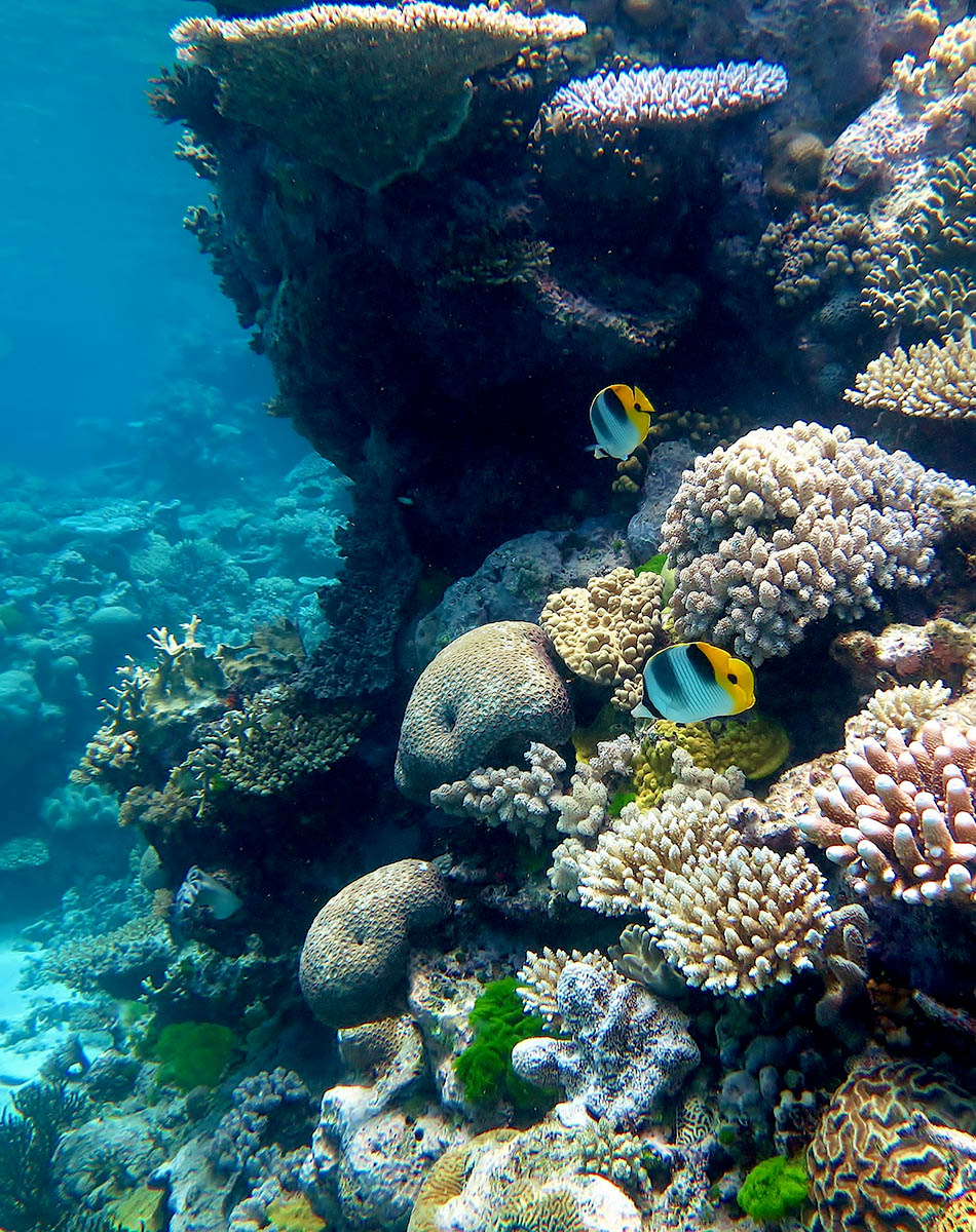
The Great Barrier Reef (GBR) is the world’s largest coral reef system, stretching along the majority of the east coast of Queensland, starting north of Fraser Island (K’gari) and ending at Cape York, a total of 2,300km. The GBR was selected as a World Heritage Site in 1981 and is contained within the GBR World Heritage Area (GBRWHA), which is approximately 348,000km2.
The GBRWHA meets all four of the criteria for natural heritage for selection as a World Heritage Site as it:
- Contains superlative natural phenomena or areas of exceptional natural beauty and aesthetic importance.
- Is an outstanding example representing major stages of earth’s history, including the record of life, significant on-going geological processes in the development of landforms, or significant geomorphic or physiographic features.
- Is an outstanding example representing significant on-going ecological and biological processes in the evolution and development of terrestrial, fresh water, coastal and marine ecosystems and communities of plants and animals.
- Contains the most important and significant natural habitats for in-situ conservation of biological diversity, including those containing threatened species of outstanding universal value from the point of view of science or conservation.
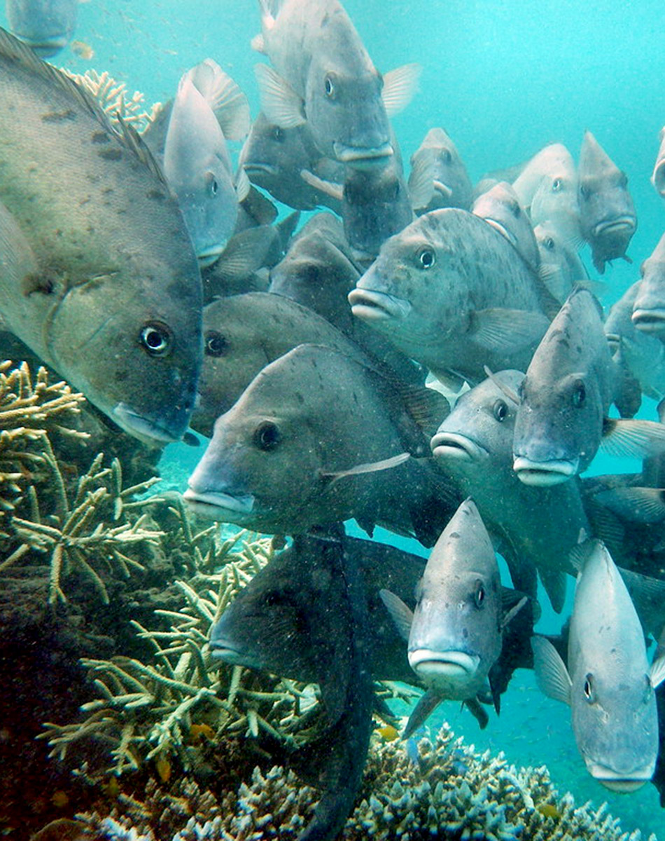
Within the GBRWHA there are some 3,000 individual reefs of varying sizes and shapes, and over 1050 islands. The diversity of habitats provided including terrestrial, estuarine and marine habitats across such a large area mean that the GBR WHA supports one of the richest and most complex natural systems on earth. This includes over 1,625 species of fish, about 600 species of coral, 4,000 species of mollusc, and 240 species of birds, plus sponges, anemones, marine worms, crustaceans, and other species.
The boundary of the Burdekin Dry Tropics NRM area encompasses the entire coast line of the region and the off-shore area from the Palm Islands group in the north to Gloucester Island in the south, with a marine area of approximately 559,836ha. Magnetic Island is also included in the Burdekin Dry Tropics region. The marine area is primarily characterised by shallow waters, supporting inshore reefs and sea grass beds and the estuarine interface between marine and freshwater environments.
The marine and estuarine areas support a wide range of fish, bird and marine mammal and reptile species, notably dugongs, dolphins and marine turtles. Beach areas such as Cape Upstart are important nesting sites for flatback turtles. The freshwater systems that connect with the GBR lagoon are also vital for species of fish that need to complete part of their lifecycle in freshwater.
There are five catchment areas that drain directly to the GBR:
- Black;
- Ross;
- Haughton;
- Burdekin; and
- Don.
The annual discharge from these catchments to the reef is 12,721GL.
The primary threats to the condition of the GBR are:
- climate change;
- land-based run-off;
- coastal land use change; and
- direct use.
Within the Burdekin Dry Tropics NRM region, the primary threat to the inshore reefs and sea grass beds that can be managed locally is land-based run-off, including fine sediment, nutrients and pesticides. For each of the five catchments listed above, there are water quality targets and priorities, primarily related to sediment and nutrients.
Above-average rainfall events and cyclones can also have a significant impact on the health of the inshore reefs and seagrass beds.
In the 2019 Reef Report card the Burdekin scored:
- Seagrass – D (Poor)
- Coral – C (Moderate)
- Water Quality – D (Poor)
Management of the Great Barrier Reef Marine Park within the GBRWHA is primarily the responsibility of the Great Barrier Reef Marine Park Authority (GBRMPA), who work under the Great Barrier Reef Marine Park Act (1975). The Reef 2050 Long Term Sustainability Plan provides the overarching strategies and framework for conservation and monitoring of the GBR. Management of GBRWHA areas outside of the Marine Park are jointly managed by GBRMPA and Queensland Parks and Wildlife Service, as part of the Department of Environment and Science. The GBRWHA stretches across six of the twelve NRM areas in Queensland; Cape York, Wet Tropics, Burdekin, Mackay Whitsunday, Fitzroy and Burnett Mary.
Current Projects:
There is currently one project funded through Reef Trust in the Great Barrier Reef area of the Burdekin Dry Tropics region; Marine Debris Clean-up and Prevention in the Great Barrier Reef. This project is managed by the Tangaroa Blue Foundation, in partnership with Conservation Volunteers Australia and is a five year project, removing and preventing litter from entering the waters of the Great Barrier Reef.
Many of the land-based projects with an agricultural focus (see Outcome 5) are also contributing to the health of the Great Barrier Reef through improvements in water quality.
Alignment with Sub-regional aspirations and regional goals:
The Great Barrier Reef lies within the following sub-regions and aligns with their sub-regional goals:
- Townsville Coastal Plains and Offshore sub-region.
Catchment to reef water management — Our community sees water as the most valuable natural asset and we need to take a holistic view on how it is managed to protect the quality of the water entering the GBR. Working with stakeholders across our region and with our neighbours, we will strive to collaboratively manage our waterways for low impact use, and diligently control sediments, nutrients and pest aquatic species (page 16)
- Lower Burdekin and Offshore sub-region.
Effective management of water and energy for productivity and the environment — Our community recognises the link between adopting innovation and profitability, and that efficient use of energy and water increases agricultural productivity and environmental protection. We will achieve this by sharing information, adopting beneficial technologies and clearly measuring results to build community resilience, successful enterprises, and the health of our local groundwater systems, rivers, wetlands and the GBR (page 18)
- Bowen catchments and offshore sub-region.
Effective management of water and energy for productivity and the environment — Our community recognises the link between adopting innovation and profitability, and that efficient use of energy and water increases agricultural productivity and environmental protection. We will achieve this by sharing information, adopting beneficial technologies and clearly measuring results to build community resilience, successful enterprises, and the health of our local groundwater systems, rivers, wetlands and the GBR
This outcome aligns with the regional goals in the NRM Plan:
- The ecological integrity and physical stability of watercourses, wetlands and marine ecosystems are restored and maintained (page 55).
- The Great Barrier Reef is protected as an exceptional natural resource (page 55).
- The unique biodiversity of the Burdekin Dry Tropics region is protected and enhanced to increase the resilience of native species, ecosystems and ecological processes (page 67).
The right to protect Country and culture is fundamental to Traditional Owners as the custodians of Country based on a history of more than 60,000 years. Traditional Owners aspire to have greater management, involvement and empowerment over Country and their cultural knowledge and understanding of Country are embraced. The Traditional Owner aspirations for the region can be found in the Burdekin Dry Tropics NRM Plan (pages 25-26), Caring for Country Plan (2005) and the Indigenous Participation Plan. Access to Country to connect and manage cultural and natural resources continue to be priorities for Traditional Owners. A map of Traditional Owner group areas can be accessed here.
The Aboriginal and Torres Strait Islander Heritage Strategy for the Great Barrier Reef Marine Park is GBRMPA’s long term strategy to strengthen protection for Aboriginal and Torres Strait Islander Reef heritage.
 Key Collaborators
This list does not cover all groups or organisations, but rather represents the ‘key’ organisations and groups whose assistance, advice, approval or cooperation would be required to work in the areas of the Great Barrier Reef that are found in the Burdekin Dry Tropics region.
- Great Barrier Reef Marine Park Authority (GBRMPA)
- Department of Agriculture, Water and Environment (DAWE)
- Queensland Department of Environment and Science (DES)
- Queensland Parks and Wildlife Service (QPWS)
- Townsville and Bowen-Burdekin Local Marine Advisory Committees (LMACs)
- Traditional owner groups including Nwaigai, Manbarra, Wulgurukaba, Bindal, Juru, and Gia.
- Local Governments (see NRM Plan Page 29)
- NQ Dry Tropics (regional NRM group)
Monitoring:
Monitoring for the Great Barrier Reef is coordinated by the Great Barrier Reef Marine Park Authority under the Reef 2050 Integrated Monitoring and Reporting Program (RIMReP), based on the Integrated monitoring framework for the Great Barrier Reef World Heritage Area. Through this, a knowledge system has been developed, where information from monitoring activities can be accessed. Results are also reported through the Reef Report Cards.
- Integrated monitoring framework for the Great Barrier Reef World Heritage Area – http://www.environment.gov.au/marine/gbr/publications/integrated-monitoring-framework-great-barrier-reef-world-heritage-area
- Reef Knowledge System – https://reefiq.gbrmpa.gov.au/ReefKnowledgeSystem/About-the-program
- RIMReP – https://www.gbrmpa.gov.au/our-work/reef-strategies/reef-integrated-monitoring-and-reporting-program
- Reef Report Cards – https://www.reefplan.qld.gov.au/tracking-progress/reef-report-card
Links and further information:
- Burdekin Dry Tropics Conservation Action Plan Summary Report
- Great Barrier Reef Marine Park Authority
- Reef 2050 Long Term Sustainability Plan
- Burdekin Water Quality Improvement Plan
- UNESCO
 Wet Tropics
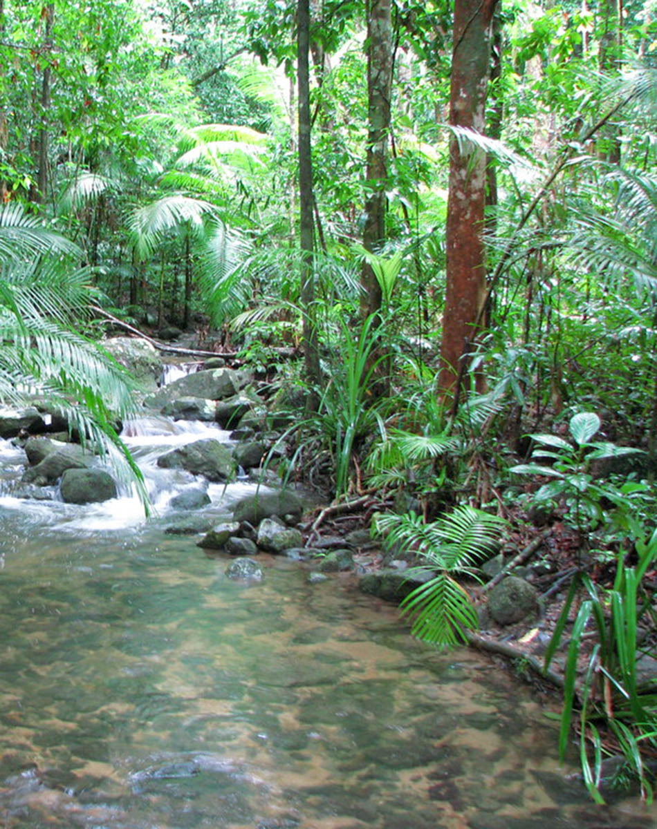
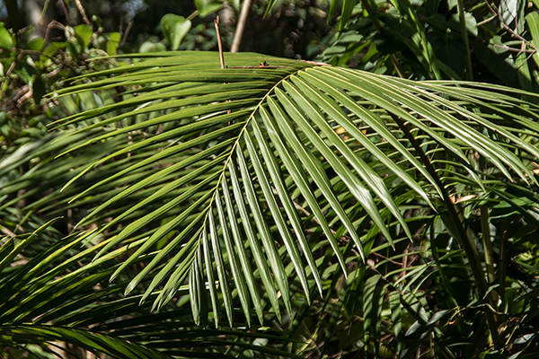
The Wet Tropics of Queensland World Heritage Area (WHA) consists of approximately 8940km2 of Australian wet tropical forests growing along the north-east Queensland portion of the Great Dividing Range. The southern-most extent of the Wet Tropics WHA is in Paluma Range National Park, covering an area of 172 km2, the bulk of which lies within the most northern extent of the Burdekin Dry Tropics region. There are over 30 National Parks who lie completely or partly within the WHA.
The Wet Tropics of Queensland had World Heritage status declared in 1988 and meets all four of the criteria for natural heritage for selection as a World Heritage Site as it:
- represents a major stage of the earth’s evolutionary history;
- is an outstanding example of ongoing ecological and biological processes;
- contains superlative natural phenomena; and
- contains the most important natural habitats for conservation of biological diversity.
The Wet Tropics WHA is home to a number of threatened plant and animal species, some of which are endemic to the Wet Tropics:
- Animal species: 4 Critically endangered, 19 Endangered and 9 Vulnerable.
- Plant species: 4 Critically endangered, 28 Endangered and 40 Vulnerable.
The Wet Tropics Bioregion also contains 185 Regional Ecosystems (18 of which are endangered, a further 134 are of concern).
Within Paluma Range National Park, there are 625 animal species recorded and 1456 plant species. This includes a number of threatened species:
- 4 Critically endangered species (3 bird, 1 reptile) – including the Eastern Curlew.
- 7 Endangered species (4 mammal, 3 bird, 1 reptile) – including the Southern Cassowary and Mahogany Glider.
There is a wide range of threats to the Wet Tropics WHA including:
- Fragmentation.
- Climate change.
- Weeds.
- Feral animals.
- Altered fire regimes.
- Altered water flows and water quality.
- Cyclones.
Additionally there are a range of pressures that impact on the WHA including:
- Regional population growth.
- Urban development and pollution.
- Demand for community infrastructure (water, roads, electricity).
- Farming (agriculture, grazing and aquaculture).
- Tourism and recreation.
The IUCN 2020 Conservation Outlook Assessment gave an overall rating of ‘Significant Concern’ for the Wet Tropics WHA, primarily due to the threat posed by invasive plants, animals and diseases, and the impacts of climate change.
Management of the larger Wet Tropics WHA is coordinated by the Wet Tropics Management Authority. The Wet Tropics Management Plan was first published in 1998 and was revised and updated in 2020. Management of the Wet Tropics WHA contained within Paluma Range National Park (and other National Parks with areas inside the WHA) is primarily undertaken by the Queensland Parks and Wildlife Service, as part of the Department of Environment and Science. The bulk of the Wet Tropics WHA is contained in the two Natural Resource Management areas of Terrain NRM and Cape York NRM who undertake activities to reduce the threats to the WHA.
Current Projects:
There are currently no projects being undertaken in Burdekin Dry Tropics area of the Wet Tropics WHA.
Alignment with Sub-regional aspirations and regional goals:
This outcome aligns with the regional goal in the NRM Plan:
- The unique biodiversity of the Burdekin Dry Tropics region is protected and enhanced to increase the resilience of native species, ecosystems and ecological processes (page 67).
The right to protect Country and culture is fundamental to Traditional Owners as the custodians of Country based on a history of more than 60,000 years. Traditional Owners aspire to have greater management, involvement and empowerment over Country and their cultural knowledge and understanding of Country are embraced. The Traditional Owner aspirations for the region can be found in the Burdekin Dry Tropics NRM Plan (pages 25-26), Caring for Country Plan (2005) and the Indigenous Participation Plan. Access to Country to connect and manage cultural and natural resources continue to be priorities for Traditional Owners. A map of Traditional Owner group areas can be accessed here.
Key Collaborators
This list does not cover all groups or organisations, but rather represents the ‘key’ organisations and groups whose assistance, advice, approval or cooperation would be required to work on the areas of the Wet Tropics that lie within the Burdekin Dry Tropics region.
- Department of Agriculture, Water and Environment (DAWE).
- Queensland Department of Environment and Science (DES).
- Queensland Parks and Wildlife Service (QPWS).
- Wet Tropics Management Authority (Division of DES).
- Nywaigi and Warrungnu Traditional Owners and Girringun Reference Group.
- Terrain NRM (regional NRM group).
- NQ Dry Tropics (regional NRM group).
 Monitoring:
Given the size and complexity of the Wet Tropics WHA, monitoring is predominantly undertaken on specific sites, or specific species. For the areas of the WHA that lie within National Park boundaries, the Queensland National Park and Wildlife Service (QPWS) is primarily responsible for monitoring.
Other monitoring programs and sources of data are available through the below link:
- Wet Tropics Management Authority periodic reports – https://www.wettropics.gov.au/periodic-reports
- Reef and Rainforest Research Centre – https://www.rrrc.org.au/rrrc-and-wet-tropics-rainforest/
Links and further information:
- Burdekin Dry Tropics Conservation Action Planning Summary Report.
- Wet Tropics Management Authority.
- Wet Tropics Strategic Plan.
- Terrain NRM.
- Cape York NRM
- Paluma Range National Park
- QLD National Parks and Wildlife Service
- IUCN World Heritage Outlook – Wet Tropics
- Reef and Rainforest Research Centre
- Biodiversity Planning Assessment – Wet Tropics Bioregion


